Travel Planner
“Where Winter Is King”
Episode #1604 Travel planner
It's back to the U.P. as we Snowmobile to Lake Superior, Tahquamenon Falls and Whitefish Point. This is an adventure to remember.
Free Guide
Fill out the form for a free area guide or to tell us what you thought of this episode.
Comment Form
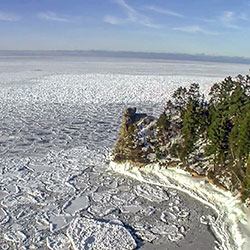
Michigan's Upper Peninsula
Renze Power Sports
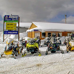
Location: E 9650 Prospect Street - Munising, MI 49862
Phone: (906) 387-3920
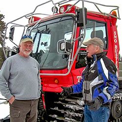
Owners Chuck and Carole Renze have been Snowmobile, ATV, and Boating enthusiasts since childhood. They both share the passion of the Upper Peninsula and the wonders that it has to offer those who not only live here but to those who come to visit as well. The sites are best seen from the numerous vantage points of the trails and lakes during all seasons of the year.
Pictured Rocks National Lakeshore
Location: 1505 Sand Point Road - Munising, MI 49862
Hours: Open year-round, 24 hours a day
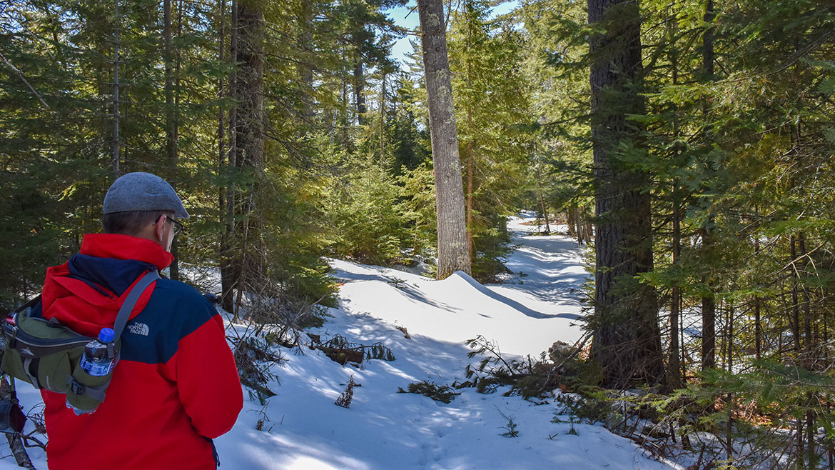
Sandstone cliffs, beaches, waterfalls, sand dunes, inland lakes, deep forest, and wild shoreline beckon you to visit Pictured Rocks National Lakeshore. The power of Lake Superior shapes the park's coastal features and affects every ecosystem, creating a unique landscape to explore. Hiking, camping, sightseeing, and four-season outdoor opportunities abound. Winter at Pictured Rocks National Lakeshore is a unique time of year. The serenity and splendor that ample snowfall brings to the northwoods offers visitors endless opportunites for adventure. What's your favorite winter activity? We have a lot to choose from: snowshoeing, cross-country skiing, snowmobiling, ice climbing, viewing ice formations, winter camping, and ice fishing.
- Pictured Rocks National Lakeshore [National Parks Service]
Tahquamenon Falls State Park
Location: 41382 W. M 123 - Paradise MI, 49768
Size: 46,179 Acres
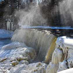
Tahquamenon Falls State Park encompasses nearly 50,000 acres and stretches 13-plus miles in Michigan's Upper Peninsula. The park is home to multiple campgrounds, overnight lodging facilities, a boat launch, more than 35 miles of trails and multiple overlooks to the Upper and Lower Falls.
The 200-feet-wide Upper Falls is one the largest waterfalls east of the Mississippi River. The river’s amber color is caused by tannins leached from the cedar, spruce and hemlock trees in the swamps drained by the river, and the extremely soft water churned by the action of the falls causes the river’s trademark large amounts of foam. Just 4 miles downstream is the Lower Falls, consisting of a series of five smaller falls cascading around an island. The falls can be viewed from the riverbank, all-accessible Ronald A. Olson Island Bridge over the Tahquamenon River or by a rowboat rented from a park concession. Drone use is prohibited.
Black bear, coyote, otter, deer, fox, porcupine, beaver and abundant bird life, including spruce grouse, pileated woodpeckers, bald eagles and a variety of waterfowl and songbirds can be found in the park. Moose are occasionally seen feeding in the wet areas of the park, especially along M-123 between Paradise and the Lower Falls.
- Tahquamenon Falls State Park [Michigan DNR]
Tahquamenon Falls Brewery & Pub

Location: 24019 Upper Falls Drive - Paradise, MI 49768
Phone: (906) 492-3300
The beautiful Tahquamenon Falls Brewery & Pub invites you to come and experience an unique brewery with fine dining and rustic charm. The Tahquamenon Falls Brewery & Pub offers a fine selection of micro brewed beers and delicious food choices. Visitors come from all over the world to experience our Upper Peninsula Restaurant and the distinctive quality of our Harvest Wheat beer, our locally caught Whitefish, a UP Pasty, Fruit of the Forest Pie, and Bison Burgers—just to name a few. Built with the founder's vision, this is a special place that echoes the Tahquamenon Falls and the surrounding virgin forests.
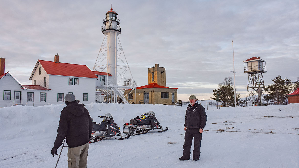
Whitefish Point Light Station
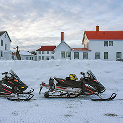
Location: 18335 N Whitefish Point Road - Paradise, MI 49768
Phone: (888) 492-3747
Whitefish Point is located at the extreme southeastern end of Lake Superior. It is a critical turning point for all vessel traffic entering and leaving this largest of all the Great Lakes. The site was placed on the National Register of Historic Places in 1973, but there was no money for restoration. In 1980, Whitefish Township approached the fledging Great Lakes Shipwreck Historical Society for assistance in preserving this important property. The Society obtained a License from the Coast Guard in 1983 to commence museum operations; opened the first exhibits in 1985; and opened the present Shipwreck Museum Building in 1987.
Snowmobile Trails - Schoolcraft County
Location: throughout Schoolcraft County, Michigan
There are snowmobiling opportunities aplenty in Schoolcraft county with hundreds of miles of groomed trails leading off in every direction regardless of where you start. The snowmobile trail system from Manistique to Munising is one of the best in the state. One the reasons a trail is good for sledding is how it is groomed and the organization that handles it and Schoolcraft County has one of the best.
- Snowmobiling [Manistique Tourism]
- Schoolcraft County Motorized Trails Association
- Jack Pine Lodge
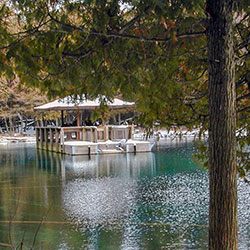
Kitch-iti-kipi (The Big Spring)
Location: Location: LAT 46.004772000000003 LONG -86.385047 at the northern terminus of state highway M-149, Manistique, MI 49854
Approximate Size: 388 Acres
Phone: (906) 341-2355
Palms Book State Park is a rewarding side trip for the vacationer touring the Upper Peninsula, for here can be seen one of Michigan's alluring natural attractions -- Kitch-iti-kipi, The Big Spring. Two hundred feet across, the 40-foot deep Kitch-iti-kipi is Michigan's largest freshwater spring. Over 10,000 gallons a minute gush from fissures in the underlying limestone. The flow continues throughout the year at a constant 45 degree Fahrenheit. By means of a self-operated observation raft, visitors are guided to vantage points overlooking fascinating underwater features and fantasies. Ancient tree trunks, lime-encrusted branches and fat trout appear suspended in nothingness as they slip through crystal waters far below. Clouds of sand kept in constant motion by gushing waters create ever-changing shapes and forms, a challenge to the imagination of young and old alike.
- Palms Book State Park [Michigan DNR]
- Kitch-iti-kipi [Visit Manistique]
Indian Lake State Park
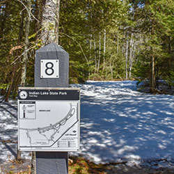
Location: 8970 W County Road 442 - Manistique MI, 49854
Phone: (906) 341-2355
Size: 847 Acres
Indian lake State Park is located on Indian Lake, the fourth largest inland lake in the Upper Peninsula with an area of 8,400 acres. It is 6 miles long and 3 miles wide. The lake was once called M'O'Nistique Lake. According to surveyor records dated 1850, Native Americans lived in log cabins near the outlet of the Lake.
- Indian Lake State Park [Michigan DNR]
- Indian Lake State Park Map [Michigan DNR 148kb]