Travel Planner
“Road Trip in the U.P.”
Episode #2112 Travel planner
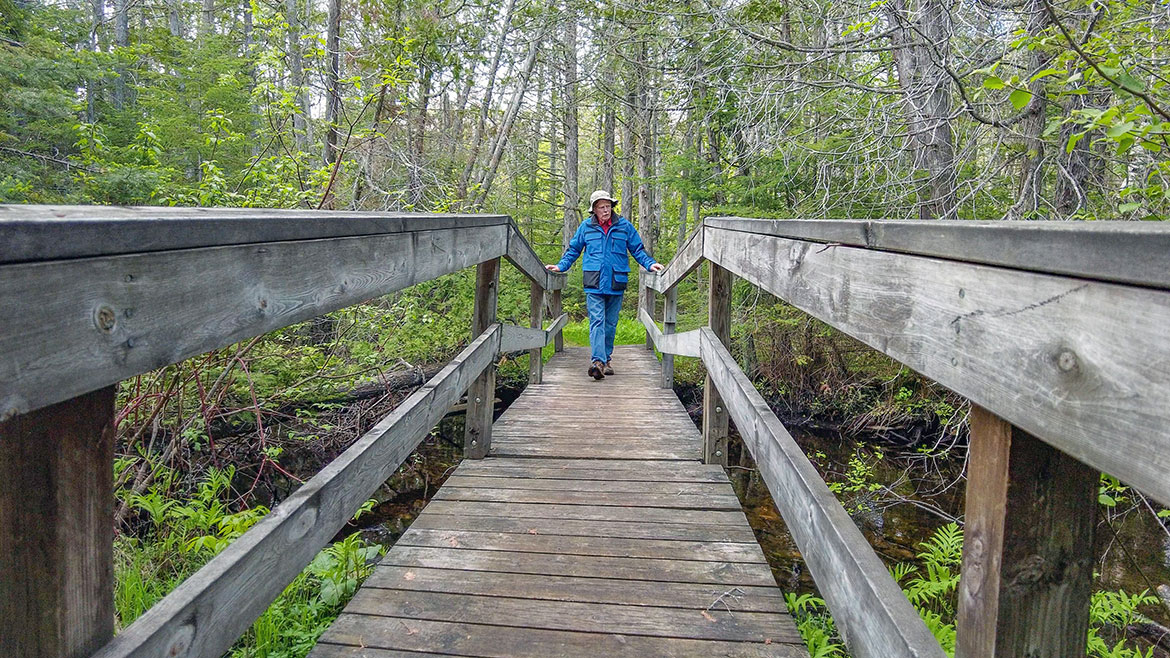
We travel the back roads of the wilderness called the Upper Peninsula in search of more Great Getaways. We find lost lakes beautiful streams and waterfalls to explore.
Mackinac Bridge

Location: on Interstate 75 at the Straits of Mackinac
Toll: $2 per axle for passenger vehicles ($4 per car). $5 per axle for motor homes, and commercial vehicles.
Phone: (586) 533-0141
Hours: 6am-10pm
The Mackinac Bridge is a suspension bridge spanning the Straits of Mackinac to connect the Upper and Lower peninsulas of Michigan. Opened in 1957, the 8,614-foot "Mighty Mac" is the world's fifth-longest in total suspension and the longest suspension bridge between anchorages in the Western hemisphere. The Mackinac Bridge connects the city of St. Ignace on the north end with the village of Mackinaw City on the south.
- Mackinac Bridge Authority
- 1989 Yugo Accident [Detroit Free Press]
Point Iroquois Light Station
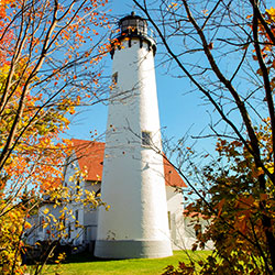
Location: 12942 W Lakeshore Drive - Brimley, MI
Phone: (906) 437-5272
Point Iroquois Light Station is located along the scenic Lake Superior shore in the Upper Peninsula of Michigan. The lighthouse museum reveals the stories of the lightkeepers and their families through family album photographs, antiques, and artifacts. Learn about the fourth order Fresnel lens that could project a light for sixteen miles. Climb the 72 steps to the top of the tower for a picturesque view of Lake Superior. Observe the freighters traveling through Whitefish Bay as you walk along a cobblestone beach in search of agates. Browse through the book shop, which offers a wide selection of historical readings about the Great Lakes. Step back in time and visit the west wing exhibit. The assistant keeper's apartment is restored to the way it looked in the early 1950s.
- Point Iroquois Light Station [Hiawatha National Forest]
- Point Iroquois Light Station [Visit Sault Ste Marie]
Bay Mills Indian Community
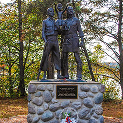
OLD INDIAN BURIAL GROUND / VETERANS MEMORIAL / SOUTH POND MINI LIGHTHOUSE
Location: 12190 W Lakeshore Drive - Brimley, MI
Along Lakeshore Drive is an old Indian Cemetery and according to the sign in the back it was established in 1841. The graves are covered with wooden Ojibwa spirit houses. The wooden houses are built to protect the body as the soul passes to the spirit world. Many times relatives would leave food and tools for the deceased loved one to use as they travel to the spirit world. The cemetery grounds are not open for entry by the public, but it is next to the road and can be easily viewed and photographed from the perimeter.
A monument to honor the veterans of the Bay Mills Indian Community stands across the street from the Old Indian Burial Ground. The three figures represent past, present and future veterans. The monument, designed by Stephen T. Landis, was dedicated on September 13, 1996. Also across Lakeshore Drive from the Burial Ground, a miniature version of the Point Iroquois lighthouse sits on the shore on South Pond.
- Old Indian Burial Ground [Detroit Free Press]
- Bay Mills Indian Community
Monocle Lake-Mission Hill Trail
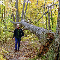
Directions to Overlook: From Lakeshore Drive turn left (west) on Tower Road and drive 1.4 miles to the overlook. The road is paved to the overlook, but is only one lane wide going up the hill. The overlook is at the right at the end of the pavement.
Mission Hill Trailhead: 1.5 miles from Tower Road, on the right
The view from this overlook is something you will not soon forget. From this place, visitors can view Lake Superior, the Saint Mary's River, Spectacle Lake, the western shore of Canada, and beautiful hardwoods mixed with towering pines. Mission Hill Trail is located near Brimley in Michigan’s Chippewa County within the Hiawatha National Forest. This is a 3.6 mile scenic out and back trail that takes hikers along the spectacular Spectacle Lake and Monocle Lake. Discover the beauty of Monocle Lake on a scenic hike. Beginning at the nearby campground, ascend the Mission Hill Trail for panoramic views of Lake Superior. Then, explore the surrounding area on the North Country Trail, enjoying a total of 4 miles of stunning scenery.
- Spectacle Lake Scenic Overlook [Hiawatha National Forest]
- Monocle Lake Interpretive Trail [Hiawatha National Forest]
- Monocle Lake - Mission Hill Trail [dwhike]
Tahquamenon Falls State Park Hiking Trails
Location: 41382 W M-123 - Paradise, MI
Phone: (906) 492-3415
Open: Year-Round
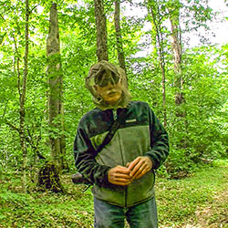
Located in Michigan's eastern Upper Peninsula, Tahquamenon Falls State Park offers over 48,000 acres of wilderness to explore, with the mighty Tahquamenon River running through it. The park is home to multiple campgrounds, overnight lodging facilities, a boating access site, 35-plus miles of trails and multiple overlooks to the Upper and Lower Falls. Many visitors are drawn to the famous Upper Falls, which at 50 feet tall and 200 feet wide is Michigan's largest waterfall. The Lower Falls, located 4 miles downstream, are equally beautiful with multiple viewing opportunities. Hiking is the most popular activity in Tahquamenon Falls State Park. You’ll be hard-pressed to find trails more beautiful and full of landmarks than those in Tahquamenon Country.
The Giant Pines Loop is a 3.8-mile hiking trail that offers visitors the sights and sounds of hemlocks, bubbling streams and surrounding wildlife. The trail also has two giant white pine trees, how the trail got its name, that have been there since the logging era in the late 1800s.
- Tahquamenon Falls State Park [Michigan DNR]
- Tahquamenon Fall State Park - Map [Michigan DNR]
- Tahquamenon Falls - Giant Pines Trail [Michigan DNR]
Pictured Rocks National Lakeshore
Location: 1505 Sand Point Road - Munising, MI
Hours: Open year-round, 24 hours a day
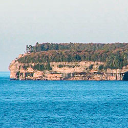
Sandstone cliffs, beaches, waterfalls, sand dunes, inland lakes, deep forest, and wild shoreline beckon you to visit Pictured Rocks National Lakeshore. The power of Lake Superior shapes the park's coastal features and affects every ecosystem, creating a unique landscape to explore. Hiking, camping, sightseeing, and four-season outdoor opportunities abound.
- Pictured Rocks National Lakeshore [National Parks Service]
Chapel Falls
Location: Pictured Rocks National Lakeshore
Chapel Falls Trailhead: about 15 miles east of Munising off Alger County Road H-58, then 5 miles north to the end of Chapel Road
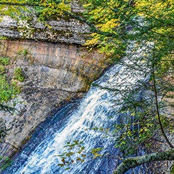
After a brisk 1.2 mile walk, hikers can view the 60-foot high Chapel Falls as it cascades toward Chapel Lake. This is one of the more remote waterfalls in the park to view. The trail is on an old roadbed with several small hills. Two viewing platforms along the way provide views of the scenic Chapel Basin. The well-maintained trail crosses the creek above the falls, leading you on a circular path to a designated viewing platform. Witness the cascading water as it dances down the rock face, creating a beautiful symphony of sound and motion.
- Chapel Falls [National Parks Service]
- Chapel Area Maps [National Parks Service]
Native American Statues
VAN CLEVE PARK
Location: 1224 Lake Shore Drive - Gladstone, MI
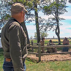
Van Cleve Park is the gem of the Gladstone community. A 27.5-acre park on the north shore of Lake Michigan that includes Gladstone Beach complete with water slide, sand volleyball courts, and beach house. A collaborative effort between the Hannahville Indian Community, Nah Tah Wahsh Public School Academy and the Gladstone Parks and Recreation Department resulted in a complete restoration of a group of statues of Native Americans in Van Cleve Park. On the western end of the Park, now within a new wooden split-rail fence, are a gathering of statues. There are five adults, three of whom are standing. One is holding a child. Before them are a black bear and two logs. All are painted cement. The statues were constructed by artist E.H. Levely downstate around 1910 and stood on private land in a couple locations before being moved to Van Cleve Park in 1988.
- Van Cleve Park [Visit Escanaba]
- Statues Restored News Article [Daily Press]
Bay de Noc-Grand Island Trail
South Trailhead: From Rapid River drive 2 miles east on US-2 to County Road 509. Turn left (southeast) on CR 509 and drive 0.6 mile, turn left (north) and continue 1 mile on CR 509 to the trailhead on the left. Parking lot is on the west side of the road.
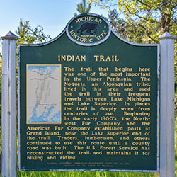
The Bay de Noc/Grand Island Trail parallels the Whitefish River, starting from 1/2 to 2 miles east of the river. The trail follows the approximate location of an ancient Chippewa Indian portage route used to carry canoes and supplies between Lake Superior and Lake Michigan. Following the river bluff for a considerable distance, it offers hikers, bikers and horse riders many extended views to the west across the Whitefish River Valley. The southern 1/4 of the trail winds along through jack pine, red pine, and aspen timber, interspersed with grassy openings. The terrain is fairly level, broken only by an occasional stream crossing.
- Bay de Noc Grand Island Trail [Hiawatha National Forest]
- Trail Map [Hiawatha National Forest]
Fresh From The Farm Greenhouses
Location: 5055W US-2 - Manistique, MI (at Duck Inn Road)
Phone: (906) 341-4447
Hours: Mon-Sat 8am-6pm, Sun 10am-4pm
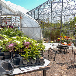
Fresh From the Farm is a quaint establishment nestled in the heart of Manistique, MI. Specializing in locally sourced produce and homemade goods, this charming spot offers a variety of fresh and wholesome products to the community. Landscaping, garden center, nursery, floral and more.
- Fresh From The Farm [Facebook]

