Travel Planner
“Spring in the Central Upper Peninsula”
Episode #2202 Travel planner
We geocache our way through some of the most scenic spots to find hidden treasure, then we are going to check out a historic bar.
Comment
Tell us what you thought of this episode and get information about the areas featured by filling out the comment form
Comment Form
Central Upper Peninsula, Michigan

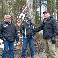
Geocaching
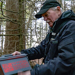
Location: worldwide
Geocaching is an outdoor treasure-hunting activity that uses GPS-enabled devices. In geocaching, participants navigate to a specific set of GPS coordinates and then attempt to find the "geocache," (usually a container or marker) at that location. Download and open the Geocaching® app to see geocaches near you. Then, select a geocache to find! Once you select a cache, go outside, and use the app to navigate to it. And don’t forget to bring a pen so you can sign the logbook inside the geocache. Once you navigate to the location, look at the recent activity and the hint for clues. Geocaches come in all shapes and sizes! Sign your username in the geocache’s logbook and place the geocache back where you found it. Log your find in the app or on Geocaching.com to see your find count increase!
- geocaching.com
- Geocaching App [Apple App Store]
- Geocaching App [Google Play Store]
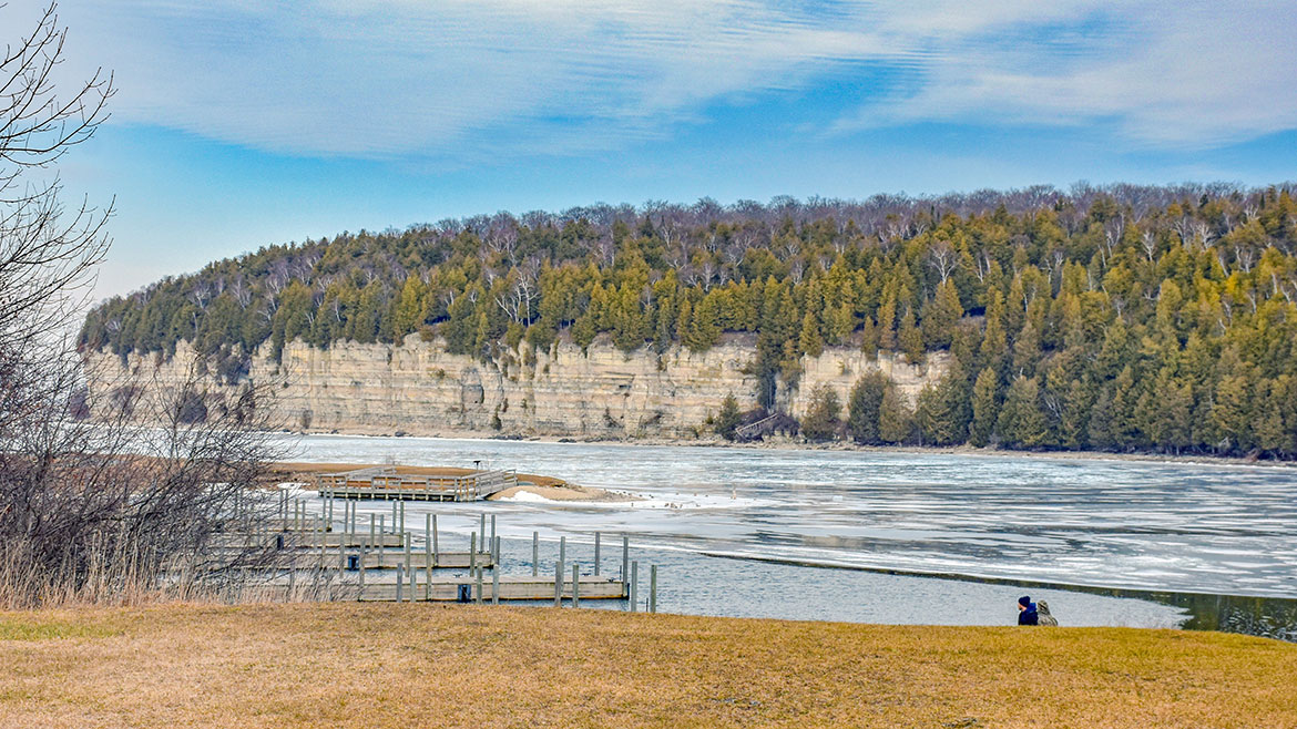
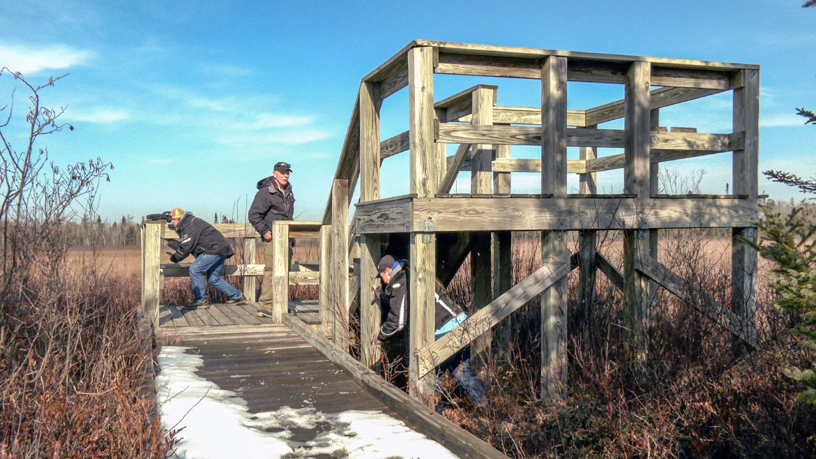
Nahma Marsh Trail
Location: Country Road 497, Hiawatha National Forest, north of Nahma, Michigan
This 0.3 mile linear trail once crept under a dense cedar forest, but a windstorm in 1997 leveled the trees leaving hikers today with broad vistas of the marsh. This hard surfaced fully accessible trail ends at a two-tiered viewing platform where an assortment of wetland wildlife can be seen. This trail will soon regain it's natural appearance as the forest heals from the effects of the wind storm.
- Nahma Marsh Trail [Hiawatha National Forest]
"River To Nowhere"
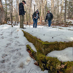
Location: E of M-183, Garden, Michigan
A little known geological oddity in the middle of the woods. A small river flows into a large sinkhole and disappears. No one knows where it flows to. You can park and grab this cache about 5 minutes off M183. Look for a large green coffee can. The difficulty is due to the need to find your way on dirt roads. Drive past the final clearing and park on the right next to the foundation of an old house.
- River To Nowhere Geocache [Geocaching.com]
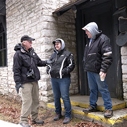
Fayette State Park
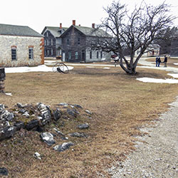
FAYETTE STATE PARK & HISTORIC TOWNSITE
Location: 4785 II Road - Garden, Michigan 49835
Phone: (906) 644-2603
Fayette was once one of the Upper Peninsula's most productive iron-smelting operations. Located on the Garden Peninsula at Snail Shell Harbor. When the charcoal iron market began to decline, the Jackson Iron Company closed its Fayette smelting operation in 1891. It is now a completely restored village including 22 historic buildings, museum exhibits and the visitor center, which can be toured May through October. The historic site is located in Fayette State Park.
- Fayette Historic State Park [Visit Manistique]
- Fayette Historic State Park [Michigan DNR]
- Fayette Historic Townsite [Michigan History Center]
- Fayette Historic State Park Map [Manistique Tourism]
Indian Lake State Park
Location: 8970 W County Road 442 - Manistique MI, 49854
Phone: (906) 341-2355
Size: 847 Acres
Indian Lake State Park is located on the shores of Indian Lake, five miles west of Manistique in Michigan’s Upper Peninsula. This 567-acre park is composed of two units, which are 3 miles apart and separated by the lake. The south unit features a modern campground overlooking the lake and the west unit features semi-modern campsites in a wooded setting. Other amenities include two Civilian Conservation Corps-era picnic shelters, a designated swim beach, a quarter-mile, paved trail along the lake and boating access site. Indian Lake is the fourth largest inland lake in the Upper Peninsula with an area of 8,400 acres. It is 6 miles long and 3 miles wide. The lake was once called M'O'Nistique Lake. According to surveyor records dated 1850, Native Americans lived in log cabins near the outlet of the Lake. Indian Lake State Park is one of the area’s most popular campgrounds and inland lake recreation areas. Indian Lake is fed by Kitch-iti-kipi and offers excellent fishing and swimming.
- Indian Lake State Park [Visit Manistique]
- Indian Lake State Park [Michigan DNR]
- Indian Lake State Park Map [Michigan DNR 148kb]
Kitch-iti-kipi (The Big Spring)
PALMS BOOK STATE PARK
Location: M-149, Manistique, Michigan 49854 (a mile north of the Co Rd 455 junction)
Approximate Size: 388 Acres
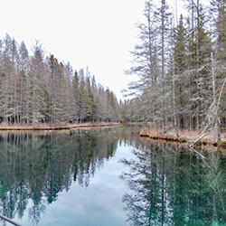
Palms Book State Park, located at the north end of Indian Lake in Michigan's Upper Peninsula, is home to Kitch-iti-kipi or "The Big Spring." Palms Book is a rewarding side trip for the vacationer touring the Upper Peninsula, for here can be seen one of Michigan's alluring natural attractions -- Kitch-iti-kipi, The Big Spring. Two hundred feet across, the 40-foot deep Kitch-iti-kipi is Michigan's largest freshwater spring. Over 10,000 gallons a minute gush from fissures in the underlying limestone. The flow continues throughout the year at a constant 45 degree Fahrenheit. By means of a self-operated observation raft, visitors are guided to vantage points overlooking fascinating underwater features and fantasies. Ancient tree trunks, lime-encrusted branches and fat trout appear suspended in nothingness as they slip through crystal waters far below. Clouds of sand kept in constant motion by gushing waters create ever-changing shapes and forms, a challenge to the imagination of young and old alike.
- Kitch-iti-kipi [Visit Manistique]
- Palms Book State Park [Michigan DNR]
Tap21
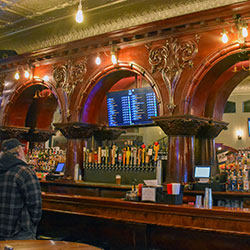
Location: 242 S Cedar Street - Manistique, Michigan
Phone: (906) 286-4455
Craft Beer Bar w/ 21 alternating Michigan Brewed Craft Beer taps, and a full menu, including appetizers, sandwiches, wraps, burgers, pasta, steak and fish! Located downtown Manistique. We feature a 1893 Brunswick Back Bar that is 24’ long by 14’ high. It’s seriously something to be admired and a hidden gem in Manistique.
- TAP21 [Facebook]