Travel Planner
“Fun Times in the Hiawatha”
Episode #2207 Travel planner
We enjoy the Hiawatha National Forest so much that today we are going to bring you some of the highlights of our trips.
Comment
Tell us what you thought of this episode and get information & guides to the areas featured by filling out the comment form
Comment Form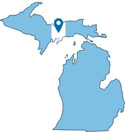
Central Upper Peninsula, Michigan
Hiawatha National Forest
Location: Upper Peninsula, Michigan
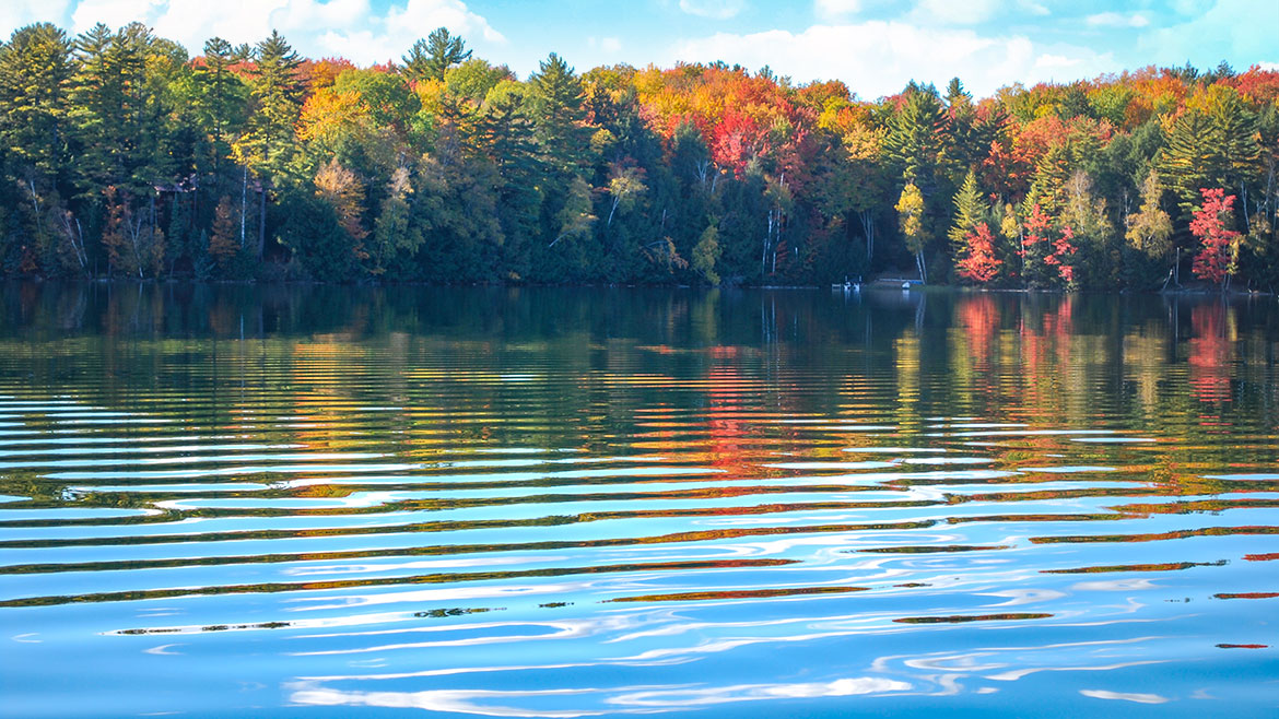
Located in the central and eastern Upper Peninsula of Michigan the Forest encompasses approximately 880,000 acres and receives 1.5 million recreational visits per year. The Forest affords visitors access to white sand, scenic beaches and relatively undeveloped shorelines. The West Unit is located in the central of the Upper Peninsula, bordering two of the Great Lakes - Lake Superior and Lake Michigan. The western portion of the Hiawatha extends from the towns of Rapid River and Manistique, along Lake Michigan, to the town of Munising on the Lake Superior shore.
Hundreds of miles of some of the best trails in Michigan's Upper Peninsula await you in the Hiawatha National Forest. Our trails take you on delightful tours of the northwoods - to remote lakes and streams where you may catch a glimpse of a loon, a soaring bald eagle, or simply to spend a day in the vast expanse of the forest. With so much water in and around the forest, there are ample opportunities to enjoy the lakes and rivers on the Hiawatha National Forest!
Hiking Bruno's Run Trail
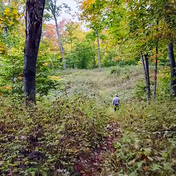
Location: The trail may be accessed from both Widewaters and Pete’s Lake campgrounds as well as from Forest Highway 13 at Moccasin Lake and Forest Road 2173 at Grassy Lake. Limited parking is available at each site.
The 9 mile loop Bruno's Run Trail winds its way past a host of small lakes etched in this relatively young glacial plain, taking hikers, bicyclists, snowshoers and skiers over gently rolling country. Further along, the trail runs over foothills, along overlooks and through valleys. The many lakes and streams in the area as well as a variety of trees and other plants make it likely that those traveling the trail will spot wildlife or tracks. If you are alert, you are sure to have an enjoyable outing. Permits are not required for camping along the trail or for campfires. Be careful with fire.
- Bruno's Run Trail [Hiawatha National Forest]
- Bruno's Run Map [ 262kb]
Indian River
WIDEWATERS CAMPGROUND
Location: Forest Road 2262 - Hiawatha National Forest | GPS - Latitude 46.21944, Longitude -86.62833
Open: May 15 - September 30
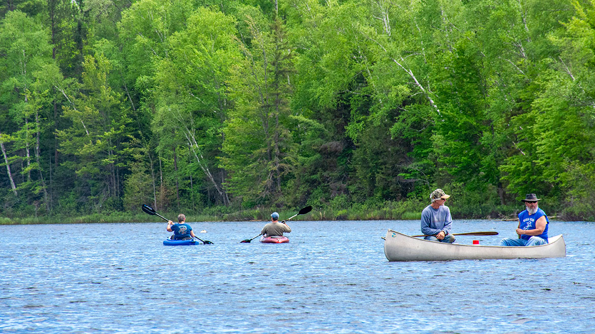
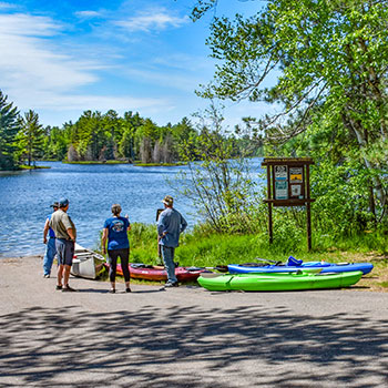
You will find at Widewaters Campground the opportunity to pursue whatever activities you desire whether it be canoeing, fishing, hiking, or just camping in a peaceful, quiet environment.
There are 34 large forested, well-spaced sites affording privacy and seclusion at each camping unit. Approved drinking water pumps and vault toilets are conveniently placed throughout the campground. Tables and grills are at each site. The campground area provides an atmosphere of relaxation. There are benches along the river where one might observe the anglers or do some bird watching, and if lucky catch a lovely sunset.
Widewaters affords boat access at the site to the Indian River, 60 acre Fish Lake and several other lakes close by. Local fish species include Largemouth Bass, Northern Pike, Bluegill, Black Crappie, Brown Bullhead and Brook Trout.
- Widewaters Campground [Hiawatha National Forest]
- Widewaters Campground Map 131kb
- Indian River Canoe Trail [Hiawatha National Forest]
Federal Forest Highway 13
Location: 36.2 miles between Nahma Junction and Wetmore
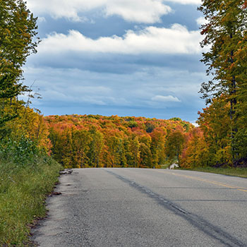
Federal Forest Highway 13 is the only signed Forest Highway in either unit of the Hiawatha National Forest (although there are other unsigned routes) and is rather well-marked in its entirety. FFH-13 runs between Nahma Junction and Wetmore. The roadway runs through rural national forest lands providing access to several campgrounds and parks. The area contains several lakes as well. The Forest Highway System dates back to the 1920s, and an earthen roadway was present along the route of FFH-13 by the 1930s. It was paved by the late 1940s and added to the county-designated highway system in the 1970s.
H-13/FFH-13 starts at an intersection with US Highway 2 west of Moss Lake. The roadway runs north through the Hiawatha National Forest, running parallel to the Sturgeon River before crossing the river near the Flowing Well National Forest Campground. The road meanders from there northeasterly through rural Delta County forests and crosses into the southeastern corner of Alger County near Straits Lake. The road continues northeasterly and then meanders back and forth along the Alger–Schoolcraft county line in an area dotted with several lakes. H-13/FFH-13 crosses east into Schoolcraft County completely and provides access to the Pete's Lake Campground before shifting back westerly to follow the county line near the Widewaters National Forest Campground; from here north the forest highway will follow the county line north to the northwestern corner of Schoolcraft County. Once the road crosses back into Alger County completely, it provides access to Wagner Falls State Park and continues to the junction with M-28/M-94 in Wetmore. H-13/FFH-13 forms a major north–south artery for the Hiawatha National Forest.
- Forest Highway 13 [Michigan Highways]
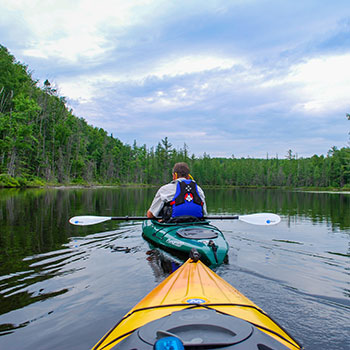
Canoeing the Corner-Straits Chain of Lakes
Location: Hiawatha National Forest near the tri-county corner of Delta, Alger and Schoolcraft Counties and just East of Forest Road 13.
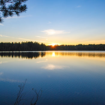
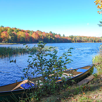
The Corner-Straits Chain of Lakes covers 477 acres in the lovely lake country of the Hiawatha National Forest. These are good bass lakes for both large and smallmouth bass, and occasionally large northern pike are taken, as well as bluegills and sunfish. There is no better way to enjoy the clearness of the air, the clarity of the skies and the boldness of the forests than to be canoeing, kayaking or fishing on the larger Straits or Corner Lakes or the number of smaller lakes they connect to. The chain consists of Skeels Lake, Corner Lake, Deep Lake, and Straits Lake.
- Hiawatha National Forest [USDA Forest Service]
- Fishing on Inland Lakes [Hiawatha National FOrest ]
Big Island Lake Wilderness
Location: Big Island Lake Wilderness, part of the Munising Ranger District of the Hiawatha National Forest, lies about one-half mile northwest of the community of Steuben - 22 miles northwest of the city of Manistique and about 18 miles southeast of the city of Munising. Big Island Lake Wilderness is bounded on the south by County Road 437 and on the west by County Road 445. The remaining border is delineated by Forest Road 2303 on the northeast and an abandoned railroad grade (Haywire Grade - Forest Road 8109) on the south side.
Hours: Open year round.
Big Island Lake Wilderness is located centrally in Michigan's Upper Peninsula. White birch, maple and aspen cover the wooded hills that surround the lakes. This wilderness contains 23 small lakes ranging in size from 5 to 149 acres. Some of the lakes are connected by maintained portages while some of the lakes are remote, making access more challenging.
Big Island Lake Wilderness offers remote, non-motorized recreation opportunities for those who want to be free of amenities -- you will find no directional signs, no restrooms, and no trashcans. There is no easy access and no wheeled or motorized equipment is allowed -- so if you want to canoe or kayak, you can't use portage wheels; you must carry your watercraft across portage trails to reach the water.
- Big Island Lake Wilderness [Hiawatha National Forest]
- Big Island Lake Wilderness - Map 316kb